Map Snippet
The map snippet allows you to add an interactive map to your pages. You can set the starting location, zoom level, and pick from red or gray pins in the WKU style. Each pin has a pop-up with the optional directions link and space for a description.
Snippet Options
HEIGHT
Controls the height of the map on the page. The map will fill 100% of the width where it is placed.
- SMALL
- MEDIUM
- LARGE
STARTING-ZOOM
Sets the zoom level of the map when the page loads. Lower zoom levels means that the map shows entire continents, while higher zoom levels means that the map can show details of a city.
- 1 to 18
STARTING-LATITUDE
Sets the latitude of the center of the map when the page loads.
Latitude GPS coordinate only. Any other content will cause errors.
STARTING-LONGITUDE
Sets the longitude of the center of the map when the page loads.
Longitude GPS coordinate only. Any other content will cause errors.
DIRECTIONS
Adds a button under the title of each popup that opens directions to that location in google maps. (Options: YES, NO)
- YES
- NO
Snippet Columns
Title
Sets the title of the pin popup.
Text Only, additional content will be removed.
Pin Color
Sets the color of the pin on the map.
- RED
- GRAY
Only use the options listed above.
Cupola Icon
Controls whether the pin has a WKU cupola icon or not. Use the cupola to distinguish WKU locations from others.
- YES
- NO
Only use the options listed above.
Latitude
Sets the latitude of the pin.
Latitude GPS coordinate only. Any other content will cause errors.
Longitude
Sets the longitude of the pin.
Longitude GPS coordinate only. Any other content will cause errors.
Description
The content of the popup. Full content is allowed, however space is limited. We recommend keeping your descriptions brief, 1 or 2 small paragraphs.
WYSIWYG content, nested snippets, components, and assets allowed.
Latitude, Longitude, and Zoom Generator
Zoom in and out on the map below to determine which starting zoom level looks best. Click anywhere on the map to move the pin and display the latitude and longitude of that location. For best results with latitude and longitude, zoom in closely on your location. This will ensure the coordinates are as accurate as possible.
Examples
Example 1
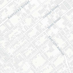
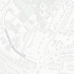
This example uses the RED pin with the Cupola Icon to mark a WKU location. Directions are enabled and there is a brief description about the location inside the popup. This map uses the SMALL height size.



| Map Snippet | |||||
|---|---|---|---|---|---|
| Options | |||||
| HEIGHT | SMALL | ||||
| STARTING-ZOOM | 15 | ||||
| STARTING-LATITUDE | 36.985202431558676 | ||||
| STARTING-LONGITUDE | -86.45575604890634 | ||||
| DIRECTIONS | YES | ||||
| Map Pins | |||||
| Title | Pin Color | Cupola Icon | Latitude | Longitude | Description |
| Bowling Green Campus | RED | YES | 36.985202431558676 | -86.45575604890634 |
Welcome to Western Kentucky University (WKU), home of the Hilltoppers. Our hilltop campus is a place of beauty and friendliness. WKU is located in Bowling Green, Kentucky, a city with a population of more than 60,000 approximately 110 miles south of Louisville and 65 miles north of Nashville. |
Example 2
This example has multiple locations and uses both the red and gray icons to indicate a primary and secondary locations. This map uses the MEDIUM height size.





| Map Snippet | |||||
|---|---|---|---|---|---|
| Options | |||||
| HEIGHT | MEDIUM | ||||
| STARTING-ZOOM | 12 | ||||
| STARTING-LATITUDE | 36.98075219497847 | ||||
| STARTING-LONGITUDE | -86.45965242063 | ||||
| DIRECTIONS | YES | ||||
| Map Pins | |||||
| Title | Pin Color | Cupola Icon | Latitude | Longitude | Description |
| Bowling Green Campus | RED | YES | 36.985202431558676 | -86.45575604890634 |
This is information about the Bowling Green Campus |
| South Campus | GRAY | YES | 36.96507642984818 | -86.46825285568544 |
This is information about WKUs South Campus |
Example 3
Locations are not limited to WKU. This example uses both the red and gray icons to indicate a primary and secondary locations, but do not use the cupola logo. Directions are off in this example and the map uses the LARGE height size.


| Map Snippet | |||||
|---|---|---|---|---|---|
| Options | |||||
| HEIGHT | LARGE | ||||
| STARTING-ZOOM | 6 | ||||
| STARTING-LATITUDE | 51.48966730942109 | ||||
| STARTING-LONGITUDE | -0.13715110388126564 | ||||
| DIRECTIONS | NO | ||||
| Map Pins | |||||
| Title | Pin Color | Cupola Icon | Latitude | Longitude | Description |
| London | RED | NO | 51.48966730942109 | -0.13715110388126564 |
Lorem ipsum dolor sit amet, consectetur adipiscing elit, sed do eiusmod tempor incididunt ut labore et dolore magna aliqua. Ut enim ad minim veniam, quis nostrud exercitation ullamco laboris nisi ut aliquip ex ea commodo consequat. |
| Brussels | GRAY | NO | 50.82822230331091 | 4.389340165068011 |
Lorem ipsum dolor sit amet, consectetur adipiscing elit, sed do eiusmod tempor incididunt ut labore et dolore magna aliqua. Ut enim ad minim veniam, quis nostrud exercitation ullamco laboris nisi ut aliquip ex ea commodo consequat. |
| Birmingham | GRAY | NO | 52.450726505248404 | -1.8950117908518394 |
Lorem ipsum dolor sit amet, consectetur adipiscing elit, sed do eiusmod tempor incididunt ut labore et dolore magna aliqua. Ut enim ad minim veniam, quis nostrud exercitation ullamco laboris nisi ut aliquip ex ea commodo consequat. |
Need Assistance?
The WKU ITS Service Desk is here to help. Give us a call, chat with a representative online, use the Self-Help Knowledge Base and more.

