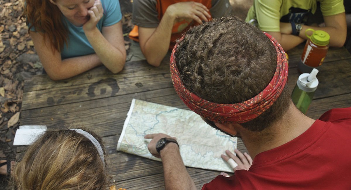
Resource Library and Pre-Built Adventures
Resources and Pre-Built Trips
ORAC Library
Want to research a topic about the outdoors? ORAC offers a resource library filled with numerous outdoor related books, maps, and DVD's. If you're planning a trip of your own, stop by to see if we have a resource to aid in your trip planning. Most of our staff are well versed in places to play both in the area and around the U.S. All books and DVD's can be rented free of charge.
Warren County Blueways
Check out this website for information about all of the different paddling opportunities in Warren County. Don't forget to check the weather!
NOAA River Conditions
Check out this website for water conditions on river all across the U.S., including local rivers such as Drakes Creek, Barren River, and Green River. Don't forget to check the weather when trip planning!
American Whitewater
Check this website for information about whitewater stream water levels, put-ins and take-outs, rapid description, and more. Don't forget to check the weather!
Mountain Bike Project
Use this website when you're looking for information about all of the mountain bike routes, whether in KY or elsewhere in the U.S. Don't forget to check the weather!
Mountain Project
Use this website for information about where to rock climb. Find descriptions of routes, difficulty levels, and descriptions of climbing destinations all on one website.
Leave No Trace
The member-driven Leave No Trace Center for Outdoor Ethics teaches people of all ages how to enjoy the outdoors responsibly, and is the most widely accepted outdoor ethics program used on public lands.
Check out these Pre-Built Trips and plan your next Adventure!
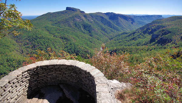
Greeter Falls Day Hike Loop
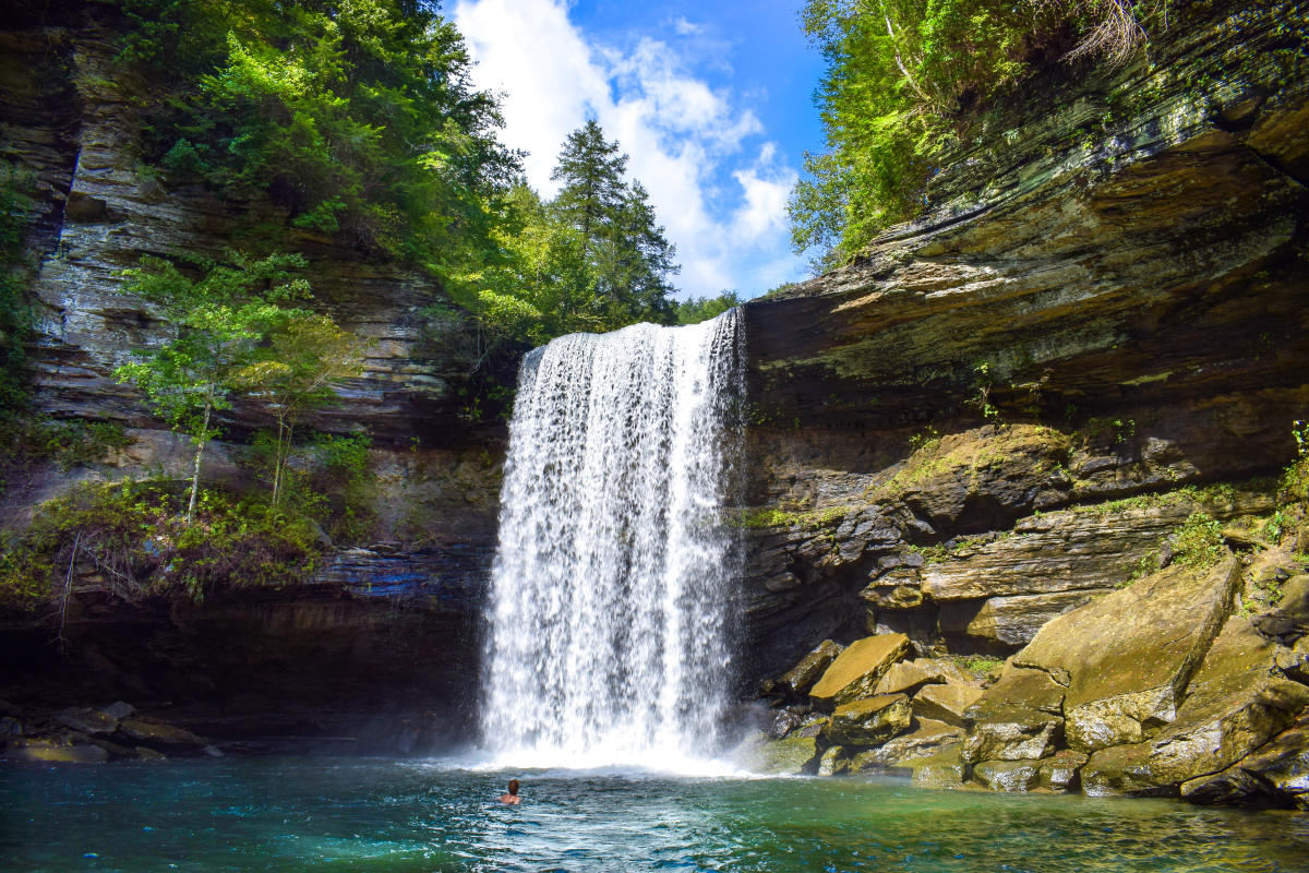
Drive time from Bowling Green: 2 hours 40 minutes
Length: 3.2 miles
Difficulty: Beginner
Things to Know: Greeter Falls Loop is a 3.2 mile hike in Altamont, Tennessee. This well traveled and well marked loop features a gorgeous waterfall that you and your leashed pup can enjoy. Watch out for rocks and roots, sandals should be brought with if you want to get in the water but should not be primary footwear! Bring your camera because this is deemed very instagramable!
Gear you’ll need: Day pack, water, snacks, bathing suit if you plan on swimming, towel, water shoes, hiking shoes, camera, trekking poles, first aid
Gear you can get from ORAC: Trekking poles, backpack, and an eno (Day Hiker Package)
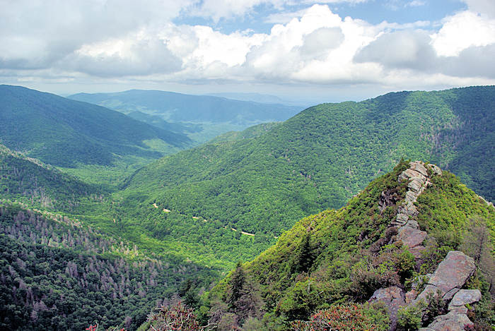
River to River trail: Garden of the Gods Wilderness Section
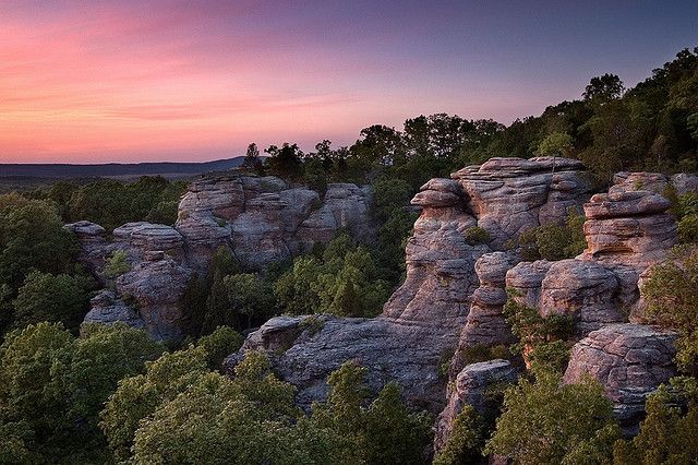
Drive time from Bowling Green: 2 hours 45 minutes
Length: 2.0 miles
Difficulty: Beginner
Things to know: This trail located in Shawnee National Forrest, IL. On this trail you will be brought to an amazing lookout. Bring your camera because this lookout is a prime place for fall colors.
Gear you’ll need: Day pack, water, snacks, hiking shoes, camera, trekking poles, first aid
Gear you can get from ORAC: Trekking poles, backpack, and an eno (Day Hiker Package)
Lost River Cave
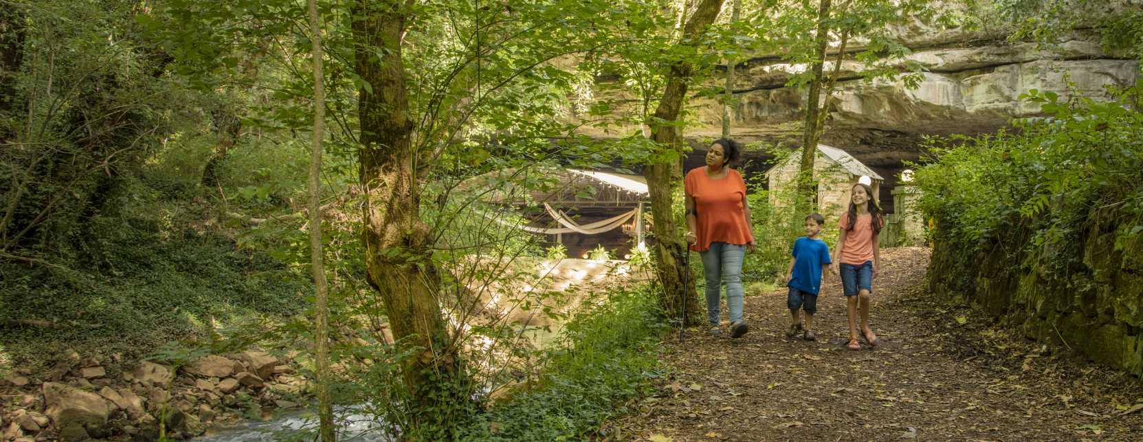
Drive Time from Bowling Green: 5-10 Minutes from WKU campus
Length: 1.3 miles
Difficulty: Beginner
Things to know: Pets allowed; Can be busy on weekends; Mostly flat; Moderate inclines.; Uneven terrain; Some rocks and roots; Free parking.
Gear you need: Backpack, water, trekking Poles, closed toed shoes, appropriate clothes, snacks, waste collection bags (if pets are on the trip).
Gear you can rent at ORAC: Backpack, trekking poles (Day Hiking Package)
Natural Bridge State Resort Park
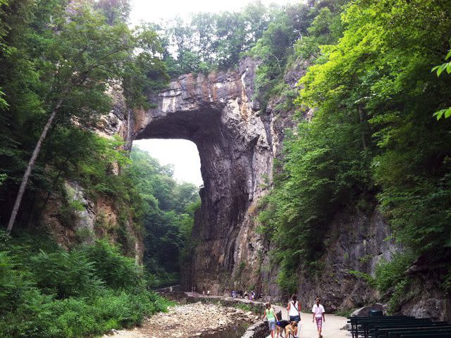
Drive Time From Bowling Green: 3 Hours (1 hour time difference)
Length: 1.2 Miles out and back or sky lift.
Location: Slade, Kentucky. Daniel Boone National Forest
Difficulty: Beginner
Things to Know: This trail can be busy. Steep inclines but plenty of benches to rest at along the way. Thin walkway through chiseled out rock (could be slightly claustrophobic). Sky lift costs $10 for adults and $7 for kids. Free parking
Gear You’ll Need: Day bag, water, appropriate footwear and clothing, optional trekking poles, optional hammock
Gear You Can Rent From ORAC: Trekking poles, backpack, hammock and straps (Day Hiking Package)
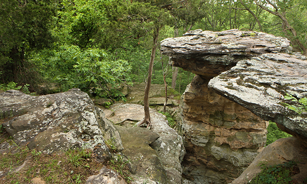
Giant City State Park
Length: 1-multiple days
Difficulty: Easy to Moderate
Drive Time: 3-3.5 hours
Things to Know: With its breathtaking natural beauty and unlimited opportunities for outdoor recreation, a trip to Giant City State Park near Carbondale is sure to delight visitors of all ages. From camping and horseback riding to fishing and rappelling, it's an outdoor lover's paradise. Visitors will marvel at the many hiking trails. Especially popular is the Giant City Nature Trail, home of the "Giant City Streets" - huge bluffs of sandstone formed 12,000 years ago. Campsites are available for reservation and range from $8-20 per day, depending on site. Visitors can enjoy picturesque natural wonders along Giant City's hiking trails, and rock climbing/rappelling are permitted in two locations.
Gear You’ll Need: sunscreen, bug spray, water bottle, closed toed tennis shoes, backpack, tent, sleeping bag, sleeping pad, 2 burner stove, mess kit, ice cooler, hammock, headlamp, trekking poles, climbing rope, climbing shoes, climbing harness, crash pad, climbing helmet
Gear You Can Rent From ORAC: backpack, tent, sleeping bag, sleeping pad, 2 burner stove, MSR cutlery set, MSR cooking set, ice cooler, hammock, headlamp, trekking poles, climbing shoes, crash pad, climbing helmet
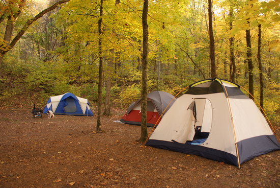
Camping Package: 4 person tent, MSR cutlery set, MSR cooking set, 2 burner stove, 2 sleeping bags, 2 sleeping pads, Icemule cooler, Eno
Day Hike Package: trekking poles, Eno, backpack
Basic Boulder Bundle: crash pad, climbing shoes, chalk bag
Resources: https://www2.illinois.gov/dnr/Parks/Pages/GiantCity.aspx
Scenic Overlook Trail At Green River Lake State Park
Length: 1 mile
Difficulty: Moderate
Drive Time: 1 hour 22 min (1 hour time difference)
Things To Know: This trail spurs off of the Marina Trail within the park, there are also other trails to explore!
Things You’ll Need: Day pack, snacks, hiking shoes, comfortable clothing, water.
Things You Can Rent From ORAC: Day hiking package
Resources: Trails
Berea Pinnacles Hiking Trails
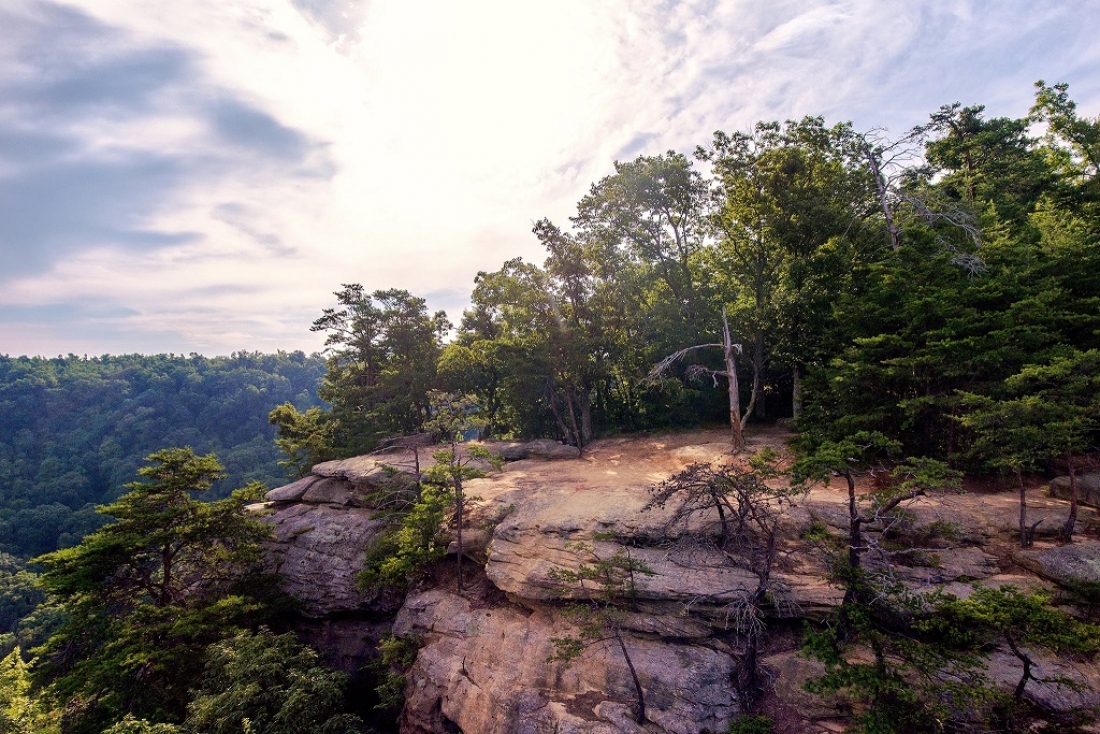
Length: 1-2 miles
Difficulty: Varying Difficulty
Drive Time: 2.5 hours
Things To Know: The Pinnacles are located in Berea, Ky. There are several different trails ranging from beginner level to difficult. This trail system has a West Pinnacle and an East Pinnacle and multiple other overlooks along the way. The entire area holds 6-8 miles of trails depending on how you hike them, trails range between .75 and 2 miles.
Things You’ll Need: Day pack, water, snacks, hiking shoes, camera, trekking poles, first aid
Things You Can Rent From ORAC: Trekking poles, backpack, and an eno (day hiking package)
Bernheim Arboretum and Research Forest
Length: 1 day/ 0.50 - 2.0 miles
Difficulty: Easy to Moderate (depending on the trail you pick)
Drive time: 1 hour 32 minutes
Things to know: No fee to get in, but $5 donation is recommended per car. Bernheim is open from 7am to 7 pm, but the visitors center and cafe are both currently closed due to COVID-19.
Gear you can rent from ORAC: Day hike package (eno, trekking poles, backpack)
Resources: Map of park and List of trails
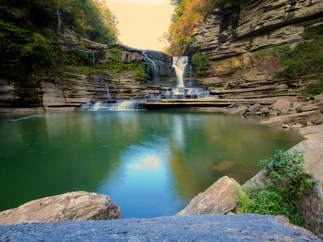
Cummins Falls State Park
Length: 1 Day
Difficulty: Easy - Moderate
Drive time: 2 Hours
Things to know: Gorge Access Permits are required for anyone who wishes to enter the gorge or access the base of the waterfall. Pets are allowed! very busy on weekends, so try to go early on weekends, or during the week if possible; currently open from 8AM – 6PM; Plenty of spots to swim around the falls.
Gear you can rent from ORAC:Day hike package (eno, trekking poles, backpack), MSR cutlery set, MSR cooking set, 2 burner stove, Icemule cooler
Resources: Info Page- https://tnstateparks.com/parks/cummins-falls
Chimney Tops via Newfound Gap Backpacking Trip
Drive time from Bowling Green: 5 hours
Length: 10.5 miles
Difficulty: Intermediate
Things to know: This hike is very popular so to avoid thru-hikers you should go May-June. To avoid the high season you should go in september. This hike is a fun way to experience the Tennessee and North Carolina side of the Park. The highest point of the Chimney Tops Trail is 4,484 feet above sea level. During this hike you will want to stay on the main trail that veers right into a creek valley on the northside of Sugarland Mountain. This part of the trail cuts through an inspiring old growth forest, but beware of tree roots so you don’t trip and fall. At the top, you’ll see one of the oldest yellow Buckeyes in the Park, and just beyond the Buckeye are two sharp switchbacks that take the hiker to the bottom of the Chimneys as they rise from Sugarland Mountain. The upper end of the trail narrows to a smaller trail called a manway. Narrowing, the trail continues on for quite a distance. At its steepest point, the manway becomes quite a climb–especially if ice has formed on the trail. The terrain can be rugged in places. So take caution. Otherwise, this hike is the perfect weekend adventure.
Gear you’ll need: Backcountry permit, backpack, good hiking boots, sleeping pad, sleeping bag, tent, camp shoes, backcountry stove and pots, your favorite trail food, appropriate clothes for your season, camera, trekking poles. Bear canister
Gear you can get from orac: backpack, sleeping pad, sleeping bag, tent, bear canister, backcountry stove, trekking poles, compass, head lamp (Backpacking Package)
Angel Falls Overlook to Grand Gap Loop Backpacking Trip
Drive time from Bowling Green: 3 hours
Length: 12 mile round-trip lollipop loop
Difficulty: Intermediate
Things to know: This loop located in Oneida, Tennessee's Big South Fork National Recreation Area is known for its stunning views. You will start your adventure at the Leatherwood Ford Trailhead parking area and follow the John Muir Trail. This will take you almost immediately crossing the Big South Fork River. Staying to the right following the John Muir Trail through the woods for about two miles you will come across backcountry campsites before the trail crosses the Fall Branch via a bridge detour (be sure to follow the detour signs) and climbs steeply to the top of the plateau. At the junction you’ll want to continue to the right to get on to the Grand Gap Loop trail along the bluff edge. Once the Grand Gap Loop Trail meets the John Muir Trail, take a left to head south. At the southern junction with the Grand Gap Loop Trail, stay right to head back down the steep hill that leads to the river and follow the trail back along the river to your car.
Gear you’ll need: Backpack, sleeping pad, sleeping bag, tent, bear canister, backcountry stove, trekking poles, compass, head lamp, food, hiking boots, camp shoes, first aid
Gear you can get from ORAC: backpack, sleeping pad, sleeping bag, tent, bear canister, backcountry stove, trekking poles, compass, head lamp (Backpacking Package)
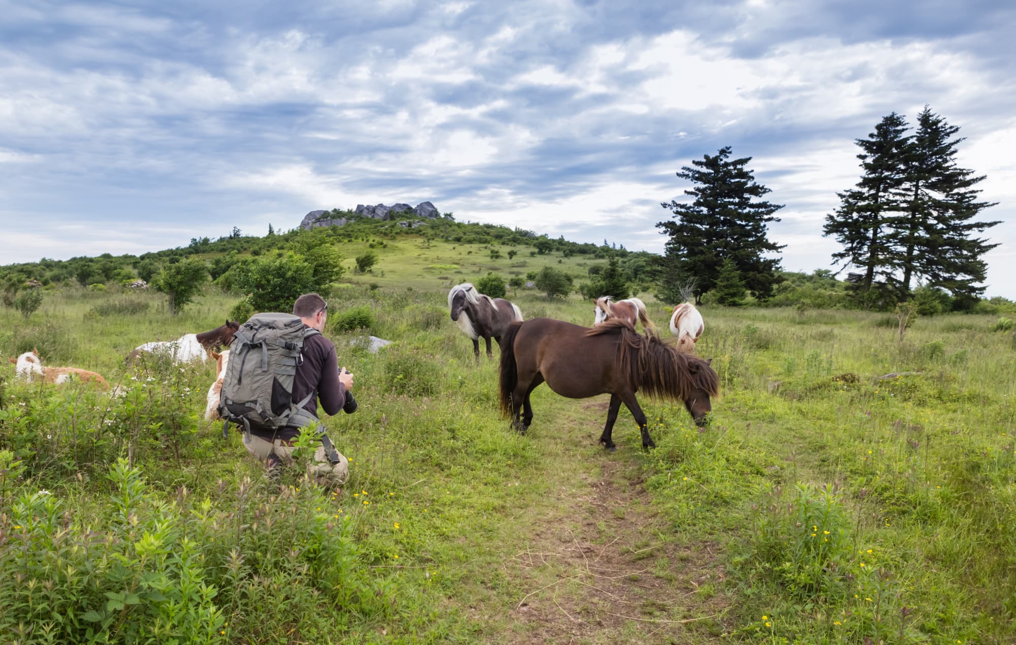
Grayson Highlands State Park
Length: 1 – multiple days, great weekend trip
Difficulty: Easy, moderate, hard hiking (depending on the trail you pick)
Drive time: ~ 6.5 hours
Things to know: Famous for wild ponies! The highest point in Virginia can be found here at Mt. Rogers (5,728 feet!). There is great bouldering for the climbers, and awesome views for hikers. Pets are welcome, and reservations for campgrounds, bunkhouses, or yurts can be made online or via phone. Parking/admission is ~$7, depending on the season. You can also find lots of rivers and lakes to swim in for a minimal fee.
Gear you can rent from ORAC: Camping Package: 4 person tent, MSR cutlery set, MSR cooking set, 2 burner stove, 2 sleeping bags, 2 sleeping pads, Icemule cooler, Eno
Basic Boulder Bundle: Climbing Shoes, Climbing Helmet, Crash Pad
Resources: Check out an example of a trip on AllTrails
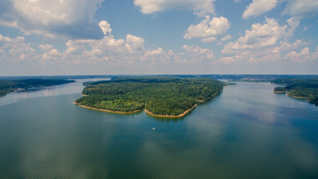
Cedar Lake
 Drive Time from Bowling Green: 4 hours
Length: 2-3 days
Location: Shawnee National Forest, Illinois
Difficulty: Moderate
Things to Know: This camping location provides many different activities, perfect for everybody. Here you can hike, motorized and non motorized boating, fishing, swimming and many other activities. Swimming is allowed at the public beach, located on the north end of the lake, administered by the city of Carbondale. Not far from the lake you can visit the Pomona Natural Bridge which has a ⅓ mile dirt and gravel path leading to a 90 foot naturally made arch or “bridge”. Not too far from Pomona Natural Bridge you can find the Little Grand Canyon trail, this 3 mile trail leads through scenic overlooks and over rocky creek beds. Perfect to go to in October or April because of season changes
Gear you’ll need: sunscreen, bug spray, water bottle, closed toed tennis shoes, tent, sleeping bag, sleeping pad, 2 burner stove, mess kit, ice cooler, hammock, headlamp. Kayak, kayak paddles, canoe, canoe paddles, paddle board, paddle board paddles, PFD,
Gear you can rent at ORAC: Camping Package, kayak, canoe, or paddle board package,
Cedars of Lebanon
Drive Time From Bowling Green: 1 hour and 30 minutes. (40 minutes from Nashville)
Length: Drive up/dump camping. Can stay for one night or up to two weeks.
Difficulty: Beginner
Things to know: All sites are drive-up and have water and electric hook-ups. There is a $5 reservation fee. Click here to make a reservation. 117 campsites can be found within Cedars of Lebanon State Park. Each site contains picnic tables, grills and RV hookups, as well as a comfortable bath house within each campground loop. This camp site is pet friendly. There is a dumping station for self-contained camping rigs. WiFi is available and firewood and ice are sold on site. There is a laundromat and camp store that are open year-round. There is an Olympic-size pool that is open seasonally from Memorial Day to Labor Day with ample room for sunbathing and a vending and snack area. There is also a disc golf course.
Gear You’ll Need: sunscreen, bug spray, water bottle, food, closed toed tennis shoes, tent, sleeping bag, sleeping pad, 2 burner stove, kitchen supplies, ice cooler, hammock, headlamp, swimsuit, disc golf disc
Gear You Can Rent From ORAC: Camping Package, optional Bocce Ball Beach Day Package or Gameday Cornhole Package, disc golf disc.
Resources:
Park Map-
https://tnstateparks.com/assets/pdf/additional-content/park-maps/cedars-of-lebanon-trail-map.pdf
Park Brochure-
Firewood Policy-
Otter Creek Park Outdoor Recreation Area
Length: 2 days & 1 night
Difficulty: Easy
Drive time: 1 hour 52 minutes
Things to know: There is a $12 campsite fee (general admission fee is waived) - you have to make reservations beforehand as they are not accepting walk-ups right now. Water is available at all A/B sites and select D/E/F sites. You must check in before 6pm with a reservation, and check out by 12pm on the following day. There are restrooms and showers on site, as well as a dumping station for gray water.
Gear you can rent from ORAC: Camping Package: 4 person tent, MSR cutlery set, MSR cooking set, 2 burner stove, 2 sleeping bags, 2 sleeping pads, Icemule cooler, Eno
Resources: Map of Campground and Info Page
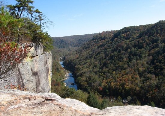
Linville Gorge Wilderness: Marion, NC
Length: Weekend / Multiple day trip
Difficulty: Easy, moderate, and hard depending on trail
Drive time: about 6.5 hours
Things to know: Sometimes referred to as the "Grand Canyon of the East," it lies entirely within the Pisgah National Forest, which is about 60 miles outside of Asheville. Notable animals to be aware of found in the Gorge include bear, copperheads and timber rattlers. Camping is allowed inside the wilderness itself, but permits are required from May 1st through October 31st. Because this is a Federal Wilderness Area, hiking trails are not well marked or well maintained. Pets are allowed! Service is super spotty so bring a map.
Gear you can rent from ORAC: Camping Package: 4 person tent, MSR cutlery set, MSR cooking set, 2 burner stove, 2 sleeping bags, 2 sleeping pads, Icemule cooler, Eno
Mammoth Cave National Park
Length: 1 – 2 days
Difficulty: easy-moderate depending on trail
Drive time: about 30 - 45 minutes
Things to know: Mammoth Cave Campground is $20 a night but make a reservation beforehand. check in at noon, checkout at 11 am, backcountry permit is free but have to get it at the visitors center, there is no entrance fee, water is available at the campground, you can tour the cave itself for some fees or you can hike around the numerous trails in the area. Make sure to check out their Camping Regulations before you visit.
Gear you can rent from ORAC: Camping Package: 4 person tent, MSR cutlery set, MSR cooking set, 2 burner stove, 2 sleeping bags, 2 sleeping pads, Icemule cooler, Eno
Day hike package: eno, trekking poles, backpack
Resources:
Map of park
https://www.nps.gov/maca/planyourvisit/maps.htm
Hiking Trails (front and backcountry)
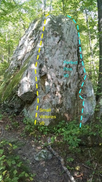
Red River Gorge: Beginning Boulder Climbing
Drive Time From Bowling Green, Ky: 3 hours and 10 minutes (One hour time difference)
Difficulty: Beginner
Location: Red River Gorge: Emerald City
Getting There: From Slade, drive south on KY11, passing by Miguel's, for 4.8 miles to a grassy meadow area and pulloff parking area on the right (37.7508, -83.66375). From the parking, cross KY11 to find a trail leading uphill. Follow the trail up to a split at a large boulder. Hike left and up the hill for Emerald City and right along a bench to the bouldering area and Global Village. (Mountain Project)
Things to know: Miguels Restaurant is a great resource for directions, advice, pizza, and gear. Bouldering has risks and crash pads and a good spotter are essential to staying safe.
Routes:
-
Watto (SDS)- V0
-
In the Middle- V0+
-
Big Toe Arete- V0+
-
The Fictitious Egg- V0+
-
Black Magic Arete- V0+
-
My Sexy Cranberry- V0+
-
Dangatang- V2
Gear You'll Need: Crash pad, climbing shoes, snacks, backpack, water, first aid, guide book, camera
Gear You Can Rent From ORAC: Climbing Shoes,Chalk Bag, Crash Pad (Boulder Bundle)
Resources and map:
King’s Bluff Climbing
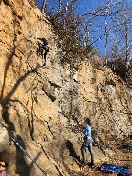
Drive time from Bowling Green: 1 hr 26min when you take US-79 S
Length: Day trip
Difficulty: Beginner to expert
Disclaimer: Climbing is a high risk sport and you are climbing at your own risk. We highly recommend that each trip should have at least one experienced climber to ensure maximum safety. If you have any questions about lead climbing outside please visit us at the Preston Center.
Things to Know: Thanks to the Southeastern Climbers Coalition Kings Bluff is open to climbers of all skill levels. In 2002 Clarksville, Tennessee donated this property to The climbers Coalition since then the climbing spot of 9.78 acres of limestone houses over 160 routes ranging from 5.3-5.13. These routes range from 30 to 8o feet in height and are sport climbing. Since it is limestone expect more crimps and power climbing. King’s Bluff is dog friendly so your furry friends are more than welcome to enjoy a day at the crag with you, but please no camping at King’s Bluff! Due to the nature of climbing and the inherent risk that comes with it, this day trip would be perfect for small groups!
King’s Bluff’s entrance is located near several businesses and I know you’ll be excited to park and start climbing but PLEASE DO NOT PARK IN THE BUSINESS’S PARKING. Instead, continue through the gate with the handy-dandy code you get from: https://www.seclimbers.org/project/kings-bluff/ (be sure to close it behind you) and park in the lot at the trailhead. While enjoying King’s Buff please only climb on established routes and do not top out! The Climbers Coalition has worked hard to maintain this great climbing spot so please follow Leave No Trace standards and report any illegal or questionable behavior to local police.
Gear you’ll need: Climbing rope, climbing shoes, climbing harness, climbing helmet, at least 6 quick draws, 2 PAS's or anchor cleaning equipment, snacks, a belay device such as a GriGri or ATC, first aid, camera, approach shoes, appropriate clothing to the season.
Gear you can get from ORAC: Climbing shoes and climbing helmet
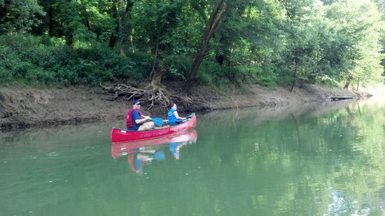
Green River through Mammoth Cave National Park- Canoe trip Dennison Ferry to Houchins Ferry
Drive time from Bowling Green: Dennison Ferry: 53 minutes; Houchins Ferry: 35 minutes
Length: 20.0 miles
Difficulty: Beginner
Things to know: At Green River, camping along the river is free as long as you have a permit! You can get this permit on site. Green river is one of the most bio diverse in the country. There are lots of wildlife species homed in the Green river. There are a reported number of 150 different kinds of fish and 70 species of mussels. On this 25 mile river there are plenty of sandbars, islands, and subsurface springs to enjoy while you float. Green river is on average 200 feet wide and 10 feet deep, although, there might be pools that are much deeper.
For this trip CALL AND CONFIRM EVERYTHING WITH KENTUCKY FISH AND WILDLIFE OR MAMMOTH CAVE. You should be asking about water levels and if your put in/take out locations are open. Because you have a put in and take out location, you will need two vehicles. One vehicle should be parked at your take out then that driver can ride with you and the rest of the group to the put in location.
Gear you’ll need: Canoe, personal flotation device (PFD), paddle, tent, sleeping pad, sleeping bag, head lamp, clothes that can get wet, water shoes, dry warm clothes for camp, camera, food,
Gear you can get from ORAC: Canoe, PFD, paddle, tent, sleeping pad, sleeping bag, headlamp
https://www.kentuckytourism.com/4-kentucky-canoe-trails-that-make-for-great-overnight-paddling-trips
https://www.nps.gov/maca/planyourvisit/canoeing-kayaking-and-boating.htm
Indian-Celina Lake Recreation Area
Length: 2-3 days
Difficulty: Easy
Drive Time: 2 hours
Things To Know: This area offers different opportunities for both overnight and day use, with two camping loops and two lakes that offer paddling, fishing and boating, and two trails for hiking. Day Use fees are required starting April 15 through October 31, at $5 a vehicle. Camping fees vary for each site and when you go, those rates can be found here.
Things you’ll need: sunscreen, bug spray, water bottle, closed toed tennis shoes, tent, sleeping bag, sleeping pad, 2 burner stove, mess kit, ice cooler, hammock. Kayak, kayak paddles, canoe, canoe paddles, PFD
Things You Can Rent From ORAC: Camping Package: 4 person tent, MSR cutlery set, MSR cooking set, 2 burner stove, 2 sleeping bags, 2 sleeping pads, Icemule cooler, Eno
Kayak Package: Kayak, paddles, PFD
Canoe Package: Canoe, paddles, PFD
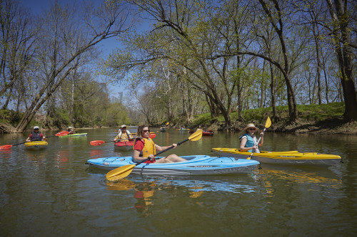
Kayaking Through Parklands in Floyd’s Fork
Drive Time from Bowling Green: 1 hour and 45 minutes (1 hour time difference)
Length: 4.4 miles (can be extended)
Difficulty: Beginner
Things to Know: Starting from this access point, you could make your trip anywhere between 2-20 miles long. Mostly flat water, but a couple areas with turbulent water. No whitewater. Call (502) 584-0350 or click on this link to check the flow of the water that day. Paddling access at North Beckley Paddling Access- 500 Beckley Creek Parkway. It is located near William F. Miles Lakes off Shelbyville Rd. This access has its own free parking and bike racks.
Gear You’ll Need: Kayak, Kayak Paddles, PFD, Kayak Trailer (if you don’t have a way to transport), Dry Bag (optional), appropriate clothing and water shoes
Gear You Can Rent From ORAC: Kayak Package (Sit-on-top Kayak, Paddle, PFD), Kayak trailer, and Dry Bag
Resources: Paddling Access Information and Map of Paddling Routes-
Canoeing or Kayaking in Harpeth River State Park
Length: 1 day
Difficulty: Options for beginners and intermediate paddlers
Drive Time: 1 hour 30 minutes
Things to Know: The Harpeth River contains canoe put-in and takeout points in close proximity, which enable a 7-mile float around a looping meander of the Harpeth in Tennessee’s Western Highland Rim. Canoe access areas are located at all sites (excluding archeological areas) providing beginner and advanced paddlers opportunities to float this beautiful class II river
Gear you can rent from ORAC: Canoe or Kayak package (includes canoe or kayak, paddles, PFD)
Big Hollow at Mammoth Cave
Length: 8.8 miles
Difficulty: Easy/Intermediate
Drive Time: 30-60 minutes
Things To Know: The 8-mile Big Hollow Trail highlights the above-ground treasures of Mammoth Cave, winding through gorgeous rock outcroppings and stream crossings. The trail was designed for the entire family, with subtle grades, an open corridor and a few more challenging alternate lines for the adventurous. Adjacent to the new trail is the Maple Springs Campground.
A round trip ride including the Maple Springs Connector, North Loop, Connector Trail, and South Loop will be close to 12 miles.
Things You’ll Need: Mountain bikes, helmet, weather appropriate clothing, water, snacks, extra tube, bike pump
Things You Can Rent From ORAC: Mountain bikes, helmets
Resources:
Freeman Park Greenbelt Trail Mountain biking
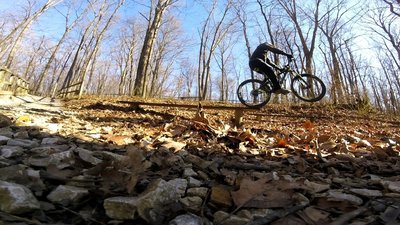
Length: 5.6 miles
Difficulty: Easy
Drive Time: Hour and 15-30 minutes
Things To Know: This 5.6 mile trail encircles Freeman Lake. Most of the trail is wide and some portions of it are paved greenway or park roads. With the exceptions of a few short, steep climbs, the trail is smooth and relatively flat
Things You’ll Need: Mountain bikes, helmets, Flat tire repair kit, bike pump, appropriate shoes and clothes, water, snacks.
Things You Can Rent From ORAC: Mountain Bike package (Mountain Bike, Bike Rack, Helmet, Pump, Flat Repair Kit)
Resources: https://www.mtbproject.com/trail/6297444/freeman-lake-greenbelt-trail
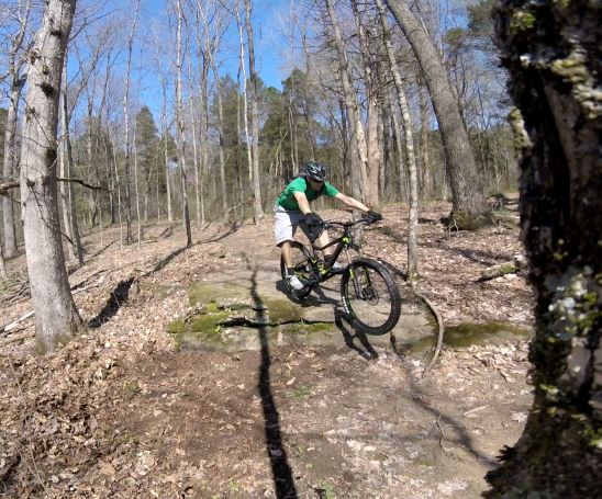
Low Hollow Mountain Biking in Weldon Peete Park
Length: 2.8 miles
Difficulty: Beginner/Intermediate
Drive Time: 10 minutes
Things To Know: The 2.8 mile loop is the first single track trail in the city of Bowling Green. Due to the popularity of the trail, there is now daily directional traffic.
Things You’ll Need: Mountain bikes, helmet, weather appropriate clothing, water, snacks, extra tube, bike pump
Things You Can Rent From ORAC: Mountain Bike Package (Mountain bikes, helmets, bike rack)
Resources: http://kymba.org/bowlinggreen/kentucky-trails/cave-city-sal-hollow/
Plan your next adventure
Use this worksheet to brainstorm your next adventure
Use this worksheet to finalize your adventure
Check out the NOLS (National Outdoor Leadership School) blog for some awesome tips on planning your next adventure!
Some of the links on this page may require additional software to view.