Ogden News
WKU students serve as interns at GIS international conference
- Wednesday, August 1st, 2012
For the 12th consecutive year, students from WKU’s Department of Geography and Geology served as interns for a Geographic Information Systems (GIS) international conference.

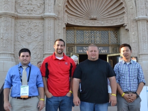
WKU students (from left) Dustin Horn, Thomas Woodall, Josh Montgomery and Huajian Zhang attended a GIS conference in San Diego.
Dustin Horn, a May 2012 GIScience graduate from Lewisport, and Huajian Zhang, a second-year Geoscience graduate student from Dalian, China, received a scholarship to participate in last week’s 33rd Annual Environmental Systems Research Institute (ESRI) International User Conference in San Diego.
Students are selected by ESRI, the world leader and pioneer of GIS, from a pool of international applicants for the competitive scholarships that support 60 graduate and fourth-year undergraduate students and graduate students from universities and colleges throughout the United States and around the world. The scholarships require students to work half-days at the conference in exchange for their conference registration, workshops, meals and lodging.
“For WKU’s GIS program to place at least one student each year, when competing with many Research I institutions, is a credit to our program,” said Dr. David Keeling, head of the Department of Geography and Geology. “WKU has become a regional and national leader in the GIS arena. Moreover, the high quality of WKU’s GIS program has resulted in several students being hired by ESRI for a variety of positions over the past nine years.”
December 2011 GIScience graduate Matt Payne is an ArcGIS Desktop Support Analyst at ESRI’s headquarters in Redlands, Calif. “Matt was offered a position with the company based on his GIS skills and knowledge that ESRI hiring personnel noted were substantially higher than other students in the intern program,” Dr. Keeling said.
Horn became the GIS Analyst for the Green River Area Development District in Owensboro a month after graduation.
Also in attendance at the conference were 2012 GIScience graduates Josh Montgomery of Auburn and Thomas Woodall of Cadiz. Montgomery is the GIS Project Manager with WKU’s Planning, Construction and Design and Woodall is the Data Infrastructure Specialist of WKU’s Facilities Management.
“This is a great opportunity for our students to network and gain knowledge and skills about today’s GIS industries,” said Kevin Cary, GIS Director and certified GIS professional (GISP). “This conference let’s them see where we are with today’s GIS outside of a classroom environment and to envision the future of GIS. Our students are very pleased and appreciative that WKU offered a very competitive program in GIScience for today’s and tomorrow’s GIS.”
ESRI, the largest organization and vendor of GIS software in the world, hosts the international conference for GIS users to share ideas and gain knowledge about GIS technology. More than 15,000 GIS professionals and educators from 130 countries attend this conference.
“GIS has become the dominant spatial analytical technique globally, with business, planning, transportation, resource, military and exploration applications,” Dr. Keeling said. “Congratulations to our GIS teaching team of Kevin Cary, GISP, Dr. Katie Algeo, Dr. Jun Yan, Debbie Kreitzer, Amy Nemon and Scott Dobler who offer a very high level of instruction.”
Contact: David Keeling, (270) 745-4555.
Some of the links on this page may require additional software to view.

